As remote sensing images gradually become
An essential information resource in daily life
Do you process images for the computer
Worried about low efficiency
Don't worry, LuoJia's "Gemini" is here
LuoJiaNET and LuoJiaSET
Enable the computer to process images
Getting smarter and smarter
Come and learn more with Luo Luojia
Can interpret and draw
The world's first remote sensing image intelligent interpretation dedicated deep learning framework "LuoJiaNET" and the industry's largest remote sensing image sample library "LuoJiaSET" jointly developed by Wuhan University and Huawei team have been launched on the Huawei Shengsi community. LuoJia "Gemini" can be open source and open to users around the world, and accept public performance testing and application development.
At present, remote sensing images are gradually becoming an essential information resource in people's daily lives, and they are increasingly relying on computers for classification, retrieval, identification, and other work. Computers need interpretation software to complete these tasks.
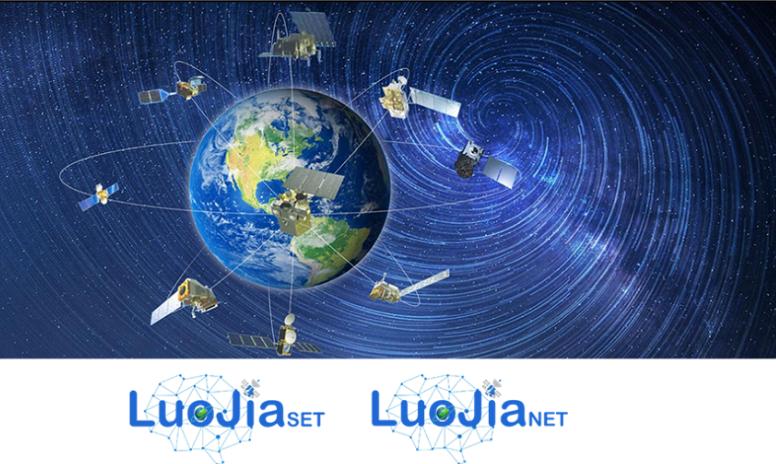
▲ LuoJiaSET, LuoJiaNET icons
LuoJiaNET is an intelligent remote sensing image interpretation software that uses artificial intelligence deep learning to make computer processing of images increasingly "smart". Professor Hu Xiangyun from the School of Remote Sensing Information Engineering at Wuhan University, the project leader, said, "Images are composed of pixels, and a major task of remote sensing interpretation is to label each pixel. What is this point, whether it is water, trees, or grasslands? It is remote sensing classification, which is also the core issue in remote sensing interpretation."
The current common practice is to cut a large image into fragments, and then parse and merge them one by one into a larger image. LuoJiaNET has been following the logical path of overall large images since the beginning of its underlying framework design. Identifying a point can connect a lot of surrounding information, including both forests and trees, in order to distinguish more accurately. The distributed computing method of using operator equivalent decomposition is used to directly process the entire large-scale remote sensing image. The entire process is like drawing a "Thousand Mile Map of Rivers and Mountains", with hills and valleys in the chest and wind and thunder under the pen. "There has been a significant improvement in interpretation accuracy," Professor Hu Xiangyun is proud of this.
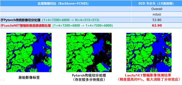
▲ Comparison of LuoJiaNET Remote Sensing Image Interpretation and Processing Strategies
A "question bank" with a collection of 5 million sheets
LuoJiaSET is a highly abundant remote sensing image sample library. The strength of LuoJiaNET lies in its ability to deeply learn and gradually improve during learning, just like a person who needs to constantly practice questions. LuoJiaSET is the "question bank" of LuoJiaNET. "The larger the question bank, the more frequent the practice, and the higher the exam score." Hu Xiangyun explained, "LuoJiaSET solves the problem of data source for interpretation software. Only when the capacity of the remote sensing image sample library is large enough and the types covered are enough can the software's advantages be fully utilized."
Compared to other remote sensing image sample libraries abroad, LuoJiaSET has over 5 million images (the international remote sensing image sample size is usually 512) × A sample size of 512 per sheet, It is expected to increase to over 10 million images this year, doubling the number. It is like a 'container' where people from all over the world can easily add data and content. LuoJiaNET serves as the underlying platform, and LuoJiaSET serves as the sample. Everyone can contribute data, models, and algorithms to it, thus forming an ecosystem. We hope that within two to three years, they can become the most widely used system in China's remote sensing industry and promote it to the whole world The world. "
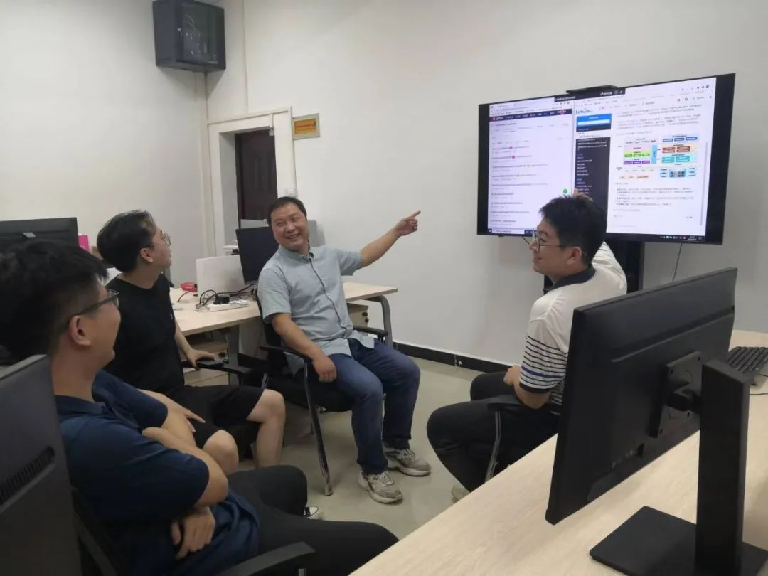
▲ Team conducts development team meetings
They are heading towards the world
Under the care and guidance of academician Gong Jianya of Wuhan University, LuoJiaNET brought together the Wuhan University team of the School of Remote Sensing, the State Key Laboratory of Surveying, Mapping and Remote Sensing Information Engineering, and the young and middle-aged academic backbone of the School of Computer Science, and the MindSpot framework team of Huawei. The two sides shared intellectual property rights and jointly applied for invention patents.
At present, the LuoJiaNET team consists of about 12 people, with an average age of 27 years old. Under the leadership of Associate Researcher Zhang Mi and in collaboration with the Huawei Ascend team, they have developed 822 megabytes (approximately 3.88 million lines) of code in the past year and a half, and finally built the LuoJiaNET system. This system includes a new deep learning framework and five basic remote sensing application models, including remote sensing scene classification, object detection, land feature classification, change detection, and multi view 3D reconstruction.
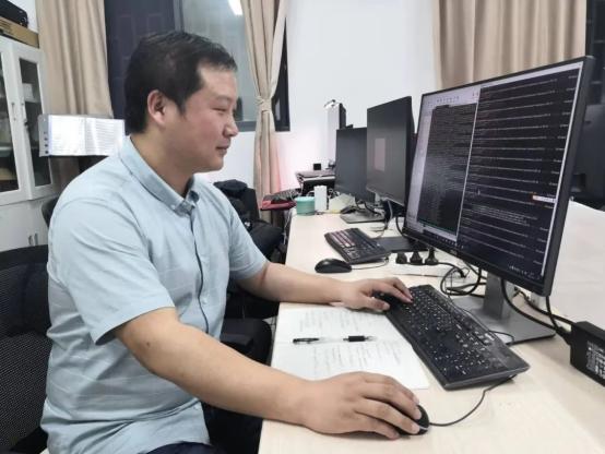
▲ Zhang Mi is developing LuoJiaNET
LuoJiaNET and LuoJiaSET are still in their early stages and require people from more fields to continue developing and filling image sample libraries based on them. Therefore, the project team has made the software open source. "We have not only placed it on Huawei's public community, but also on overseas websites. We welcome everyone to come here to 'move bricks' and expand their circle of friends," Professor Hu Xiangyun humorously told Luo Luojia.
Just like Windows on a computer or HarmonyOS on a mobile phone, LuoJiaNET is also a basic software. "It's like a house, and LuoJiaNET is the brick that builds a house. Anyone can develop various application software on top of it and use our bricks to build different houses," said Professor Hu Xiangyun, "For example, in today's popular autonomous driving, in car cameras need to perform image recognition and analysis while driving, and their models can also be built based on it. In the future, these 'bricks' will be built on mobile phones and satellites without any problems."
And LuoJiaSET is like an unfilled "question bank", where people from all over the world can fill in data and "add questions", allowing LuoJiaNET to "brush more questions" and play a more powerful role.
Professor Hu Xiangyun said, "LuoJiaNET is completely independently developed by us. It supports mainstream CPUs, GPUs, and Windows and Linux operating systems, and has optimized Huawei's Ascend NPU artificial intelligence software and hardware. Remote sensing is a strategic technology, and LuoJiaNET can achieve independent and controllable remote sensing interpretation in China."
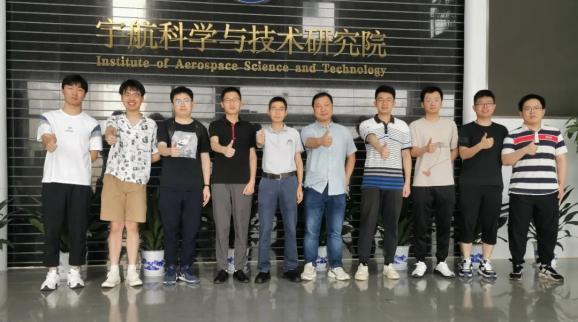
▲ Wuhan University R&D team, Hu Xiangyun (fifth from the left), Associate Researcher Zhang Mi (sixth from the left, responsible for LuoJiaNET), and Associate Researcher Jiang Liangcun (fourth from the left, responsible for LuoJiaSET)
3.88 million lines of code
Sample size of over 5 million sheets
LuoJia Gemini“
Gathering the hard work and sweat of the R&D team day and night
Self reliance and independent innovation
Going global and benefiting humanity
Wuhan University researcher
Always on the road!