News Network (Correspondents Cai Liefei and He Jinglin) On March 18, the "Seminar on the Major Research Program Achievements of the Basic Theory and Key Technologies of Spatial Information Network" organized by the State Key Laboratory of Surveying, Mapping and Remote Sensing Information Engineering of Wuhan University was held in Wuhan University. Academicians Li Deren, Gong Jianya, Cao Xibin, Jiang Bitao, Deputy Director of the Information Science Department of the National Natural Science Foundation of China He Jie, Mayor of Haiyang Jiang Dan, Deputy Secretary of the School Party Committee Qu Wenqian, as well as dozens of industry experts and enterprise representatives attended the conference. Gong Jianya, academician of the CAS Member, presided over.
At the opening ceremony, Qu Wenqian delivered a speech thanking all academicians, experts, and enterprises for their long-term support and assistance in the field of surveying, remote sensing, and aerospace information at Wuhan University. He Jie proposed to take the project completion and excellent evaluation as a new starting point, further promote the application of major research plan achievements, fully tap into the value of disciplines, and effectively promote the rapid development of China's remote sensing industry. Li Deren reviewed the approval process of the major research program on the basic theory and key technologies of spatial information networks. Through nearly a decade of research and practice, the project has completed the validation of some key technologies. Academician Li Deren also expressed his determination to "live until old, learn until old, and work until old", hoping that various units in the fields of surveying, mapping, remote sensing, and aerospace information will unite and cooperate to contribute to the country and the people.
Professor Wang Mi, the chief designer of the 01 satellite of Shuangqing-1/Luojia-3, gave a detailed report on the background of satellite development, technological innovation, and scientific experiments. The Shuangqing-1 scientific experimental satellite is a new generation of Internet intelligent remote sensing satellite platform that combines "multimode, open, intelligent, and interconnected". In response to the problems of long traditional remote sensing business links and slow system response, a new technological system of "high-precision positioning and intelligent processing technology for satellite ground cooperation in orbit" has been constructed, Created a new model of in orbit processing and real-time transmission services for internet intelligent remote sensing satellites targeting ground mobile terminals. This new model breaks the traditional satellite remote sensing data service model, shortens the time for satellite data acquisition, processing, transmission, and distribution, and can effectively improve the dynamic emergency response efficiency of emergencies, providing strong support for the popularization of remote sensing data mobile terminal services. At present, the in orbit scientific test of Shuangqing-1 shows that it takes only about 8 minutes from the satellite end to the user's mobile terminal receiving and displaying satellite video data, achieving real-time intelligent remote sensing information services at the minute level.
Professor Hu Xiangyun from Wuhan University reported on the achievements of LuoJiaNET and LuoJiaSET. This achievement addresses the bottleneck problem of intelligent remote sensing interpretation. Led by him, young research teams such as Associate Researcher Zhang Mi and Associate Researcher Jiang Liangcun collaborated deeply with Huawei's Ascend AI team to jointly create the first fully stack autonomous and controllable deep learning framework in the remote sensing field, LuoJiaNET, and the industry's largest remote sensing image sample library, LuoJiaSET, forming a set of frameworks (remote sensing characteristics), LuoJiaNET, and a sample library (largest), LuoJiaSET, A set of crowdsourcing sample collection tools, an open-source remote sensing interpretation community, and a series of scientific research achievements such as knowledge embedding and interpretability analysis. Since the launch of LuoJiaSET and LuoJiaNET, there have been over 4000 registered users in more than 20 countries (mainly from Europe, the United States, and Asia), effectively promoting the application of related achievements in industries such as natural resource monitoring and agricultural remote sensing.
On the day of the seminar, the final award ceremony of the 2022 Aerospace Hongtu Cup Remote Sensing Image Intelligent Processing Algorithm Competition was also held. This competition has received high attention from the National Natural Science Foundation of China, and has received positive responses from companies such as Aerospace Hongtu Information Technology Co., Ltd. and Huawei Technology Co., Ltd. It has also received support from the International Society for Photogrammetry and Remote Sensing (ISPRS), aiming to promote innovation and development of artificial intelligence technology in the field of remote sensing imaging through competition, To provide support for the significant improvement of spatial information processing and application capabilities.
Under the leadership of the Information Science Department of the National Natural Science Foundation of China and the Guiding Expert Group of the Major Research Program on Basic Theory and Key Technologies of Spatial Information Networks, this competition has been successfully held for six sessions. Since the contest began on August 18, 2022, a total of 1475 developers from 676 teams from more than 15 countries, including China, the United States, the United Kingdom, the Netherlands, Türkiye, Australia and Pakistan, have signed up for the contest. The international track will determine the final winning position on November 20, 2022, while the two domestic track questions will undergo a 36 hour real-time competition and evaluation and defense session from March 16 to 18, competing fiercely to determine the final winning position.
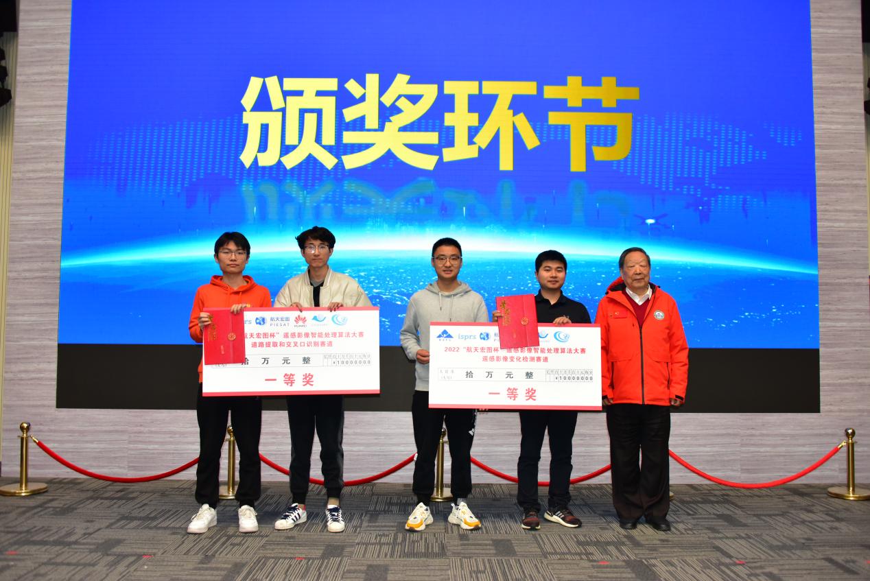
Researcher Pan Jun, member of the organizing committee of the competition, reported on the situation of this competition. Liao Tongkui, General Manager of Aerospace Hongtu Information Technology Co., Ltd., announced the list of winners for the "Remote Sensing Image Change Detection" competition, while Wu Xiaodong, Director of Huawei Technology Co., Ltd.'s Huawei Cloud Internet Business Department, announced the list of winners for the "Road Extraction and Intersection Recognition" competition. Li Deren, Cao Xibin, and Jiang Bitao respectively presented award certificates to the first, second, and third prize winning teams.
Subsequently, the launch ceremony of the 2023 "Guofeng Oriental Wisdom Eye Cup" Remote Sensing Image Intelligent Processing Algorithm Competition was held. The competition has received strong support from the government of Haiyang City, Shandong Province, as well as continuous support from Aerospace Hongtu Information Technology Co., Ltd. Jiang Dan delivered an enthusiastic speech, warmly welcoming domestic and foreign research teams to actively participate in the 2023 competition, and inviting participating research teams to innovate and start businesses in Haiyang. The 2023 competition is currently named by Yantai Guofeng Investment Holding Group Co., Ltd., sponsored by Aerospace Hongtu Information Technology Co., Ltd. and China Electric Power Construction Group Shandong Electric Power Construction First Engineering Co., Ltd.
He Jie, Gong Jianya, Jiang Dan, Liu Zhijun, Deputy General Manager of Yantai Guofeng Investment Holding Group Co., Ltd., Liao Tongkui, General Manager of Aerospace Hongtu Information Technology Co., Ltd., and Ma Xianqiu, General Manager of Shandong Electric Power Construction First Engineering Co., Ltd. Qingdao Company of China Electric Power Construction Group, as guests at the launch ceremony, jointly lit the lantern ball symbolizing the 2023 annual competition.