On August 9th, at the second meeting of the Intelligent Remote Sensing Open Source Ecological Alliance with the theme of "co drawing a new blueprint for innovative remote sensing applications", the "LuoJiaNET/LuoJiaSET Industrial Application White Paper" was officially released based on the launch and application of the world's first remote sensing image intelligent interpretation dedicated deep learning framework "LuoJiaNET" and the industry's largest remote sensing image sample library "LuoJiaSET" jointly developed by Wuhan University and Huawei team.
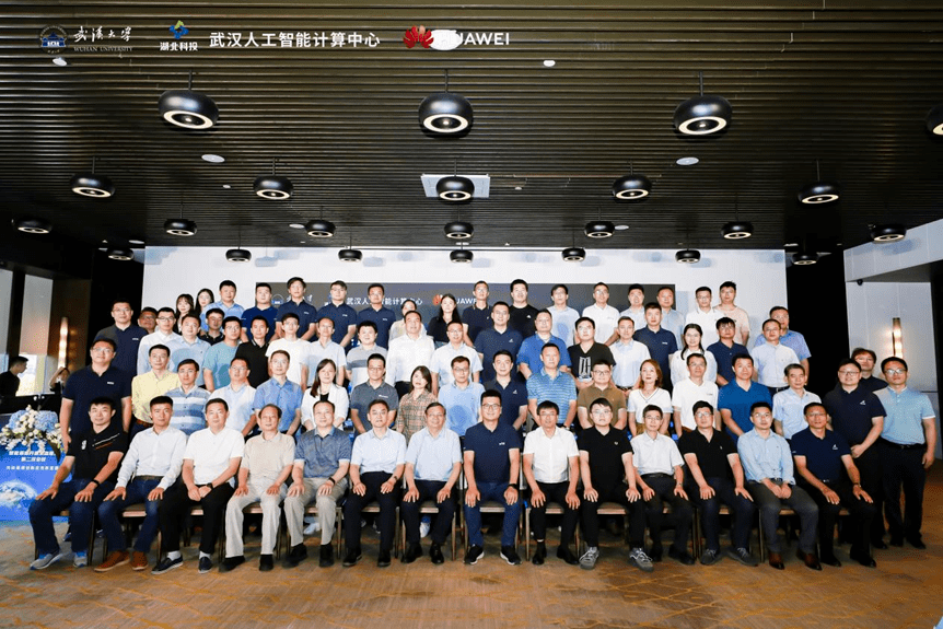
Group photo of alliance members
The second conference of the Intelligent Remote Sensing Open Source Ecological Alliance is jointly hosted by Wuhan University, Wuhan Artificial Intelligence Computing Center, and Huawei Technology Co., Ltd. It is led by the world's first open-source remote sensing image intelligent interpretation machine learning dedicated framework, LuoJiaNET, developed by Wuhan University, and the industry's largest remote sensing image sample library, LuoJiaSET, built to gather innovation and application forces, incubate the application achievements of the intelligent remote sensing industry, Create a new space for the remote sensing industry. At the meeting, representatives from multiple enterprises and universities shared and discussed industry application practices and cutting-edge research topics in the field of remote sensing, discussing the new future of the remote sensing industry together.
Co drawing a new blueprint for innovative applications
Professor Gong Jianya, academician of the CAS Member, addressed the conference. He stated that with the support of the National Natural Science Foundation of China's major research program integration project, Wuhan University and Huawei collaborated to jointly build the world's first remote sensing image intelligent interpretation dedicated framework, LuoJiaNET, and the industry's largest remote sensing image sample library, LuoJiaSET, with the support of the computing power of the Wuhan Artificial Intelligence Computing Center. To further promote the industrial implementation of scientific research achievements, Wuhan University, Huawei, and the China Remote Sensing Application Association have jointly initiated the establishment of the Intelligent Remote Sensing Open Source Ecological Alliance.
Gong Jianya, academician of the CAS Member, delivers a speech
Jiao Licheng, a foreign academician of the European Academy of Sciences and the Russian Academy of Natural Sciences, proposed suggestions for the operation of the alliance in his speech: firstly, unite and do something together in the field of intelligent remote sensing; The second is collaboration, where each member enterprise of the alliance will have its own endowments or different characteristics, and collaborate to overcome all difficulties; The third is to work hard and make achievements in remote sensing core technology, leading the way in technology.
Zhou Zikuan, Deputy Secretary General of the China Remote Sensing Application Association, stated that the development of the Intelligent Remote Sensing Open Source Ecological Alliance mainly relies on two points: first, artificial intelligence, Wuhan LuoJiaNET is a unique feature of our alliance; The second is data. More and more data is now available for free and open source, which also brings new opportunities for the development of remote sensing ecology and alliances.
Zhang Dixuan, President of Huawei's Ascend Computing Business, stated that after more than half a year of development, member companies of the alliance, such as Shanghai Shuhui, Handa Rui, Wuhan Jiahe Technology, etc., have begun to have corresponding remote sensing innovation and implementation plans, confirming the foresight and correctness of establishing the alliance. In the future, Huawei will continue to provide stronger support to alliance partners based on Ascension AI, empowering the industry with the latest achievements of the alliance, and better providing high-end, high-quality, and convenient services to the country and society.
Co promoting the flourishing development of remote sensing
The vigorous development of remote sensing field cannot be separated from the joint efforts of industry enterprises. At this meeting, a total of 36 newly joined member units of the Remote Sensing Alliance were awarded medals. Collaborate with industry partners to explore new paths for remote sensing innovation and development, jointly build a new highland for cutting-edge remote sensing technology, and accelerate the process of scientific research and innovation to industrial implementation. Professor Hu Xiangyun from the School of Remote Sensing Information Engineering, as the Secretary General of the Alliance, received the award from Wuhan University as the Chairman Unit.
Award by the Chairman of the Alliance
Award by the Vice Director Unit of the Alliance
Heavily released in Wuhan LuoJia White Paper
At this meeting, Zhang Mi, Deputy Researcher of the School of Remote Sensing Information Engineering at Wuhan University, as the Deputy Secretary General of the Alliance, released the "LuoJiaNET/LuoJiaSET Industrial Application White Paper", which mainly includes the key technologies and industrial application guidance of the world's first intelligent interpretation framework for remote sensing images, LuoJiaNET, and the industry's largest remote sensing image sample dataset, LuoJiaSET, Intended to guide alliance members to quickly complete model training, optimization, inference, etc. based on LuoJiaNET and LuoJiaSET, and quickly apply scientific research results to the industry.
Zhang Mi, Deputy Secretary General of the Alliance, released the "LuoJiaNET/LuoJiaSET Industry Application White Paper" on behalf of the Alliance
Outlook for the New Future of Remote Sensing
At the meeting, Zhang Bing, consultant of the Alliance and vice president of the Aerospace Information Innovation Research Institute of the Chinese Academy of Sciences, made a clear outlook on the development trend of remote sensing satellite application technology: first, multimodal remote sensing is an important development direction, and second, event prediction with in-depth coupling of model data. In the industry, the relationship between future intelligent remote sensing satellite systems and augmented reality is an emerging growth point in the future.
Hou Biao, Alliance Consultant and Executive Dean of the School of Artificial Intelligence at Xi'an University of Electronic Science and Technology, introduced remote sensing image intelligent interpretation technology and its application cases.
At the event, member companies of the alliance, including Shanghai Shuhui, Handa Rui, Aerospace Hongtu, and Wuhan Jiahe Technology, shared their latest industry solutions based on the alliance's innovative achievements.
At the end of the meeting, Hu Xiangyun, the Secretary General of the Alliance, led all members of the Alliance to read out the Alliance's vision: to unite remote sensing industry, academia, and research forces to overcome difficulties, create an independent, open, and advanced intelligent remote sensing technology ecosystem, expand social circles, and serve the world!